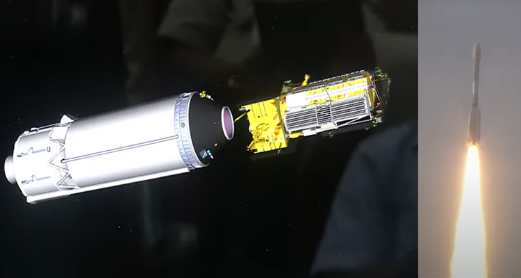
Sriharikota: In a landmark moment for global space collaboration, the NASA-ISRO Synthetic Aperture Radar (NISAR) satellite was successfully launched today from the Satish Dhawan Space Centre (SDSC), Sriharikota, aboard the GSLV-F16 rocket. The Indian Space Research Organisation (ISRO) confirmed the launch on the microblogging platform X (formerly Twitter), hailing it as a major leap in Earth observation and climate monitoring efforts.
The NISAR mission, a collaborative effort between NASA and ISRO, aims to monitor Earth’s land and ice surfaces with unprecedented accuracy. The satellite is equipped with dual-band Synthetic Aperture Radar (SAR) technology, using both L-band (NASA) and S-band (ISRO) frequencies. This unique configuration allows it to capture high-resolution, all-weather, day-and-night imagery, essential for monitoring natural disasters, agricultural patterns, glacier movements, and coastal changes.
The satellite will image nearly the entire globe—including landmasses, ice sheets, sea ice, selected oceanic regions, and islands—every 12 days, making it one of the most comprehensive Earth observation platforms ever launched.
This mission is expected to play a crucial role in climate change studies, natural resource management, and disaster resilience planning. It also marks a significant milestone in India–US space cooperation, following years of joint technical development and coordination.
With NISAR, India and the United States reaffirm their shared commitment to scientific innovation, climate research, and the peaceful use of outer space for the benefit of humanity.